


Completed Projects - Road and Sidewalk Improvements
The following list contains all of the Road and Sidewalk Improvement Projects completed by the Agency. You may scroll through the projects, or if you are looking for a certain project, just click on that item on the list below to go directly to it.
- 7th Avenue Improvements
- 7th Avenue North of Eaton Street Improvement Project
- 7th Avenue Sidewalk (Capitola Dr. to Soquel Ave.)
- 14th Avenue Improvement Project
- 16th Avenue Improvement Project
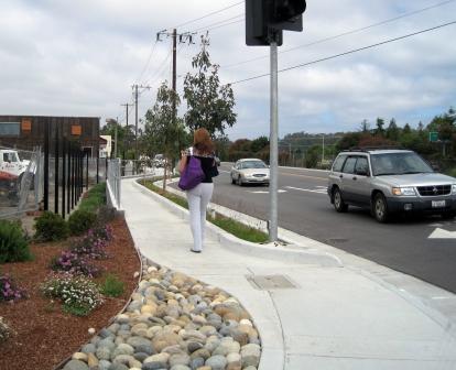
- 17th Avenue Road Improvement Project (Brommer St to Capitola Rd)
- 17th Avenue Road Improvement Project (Portola Drive to Brommer St)
- 30th Avenue Improvement Project (Portola Drive to Brommer Street)
- 38th Avenue and Garden Street Improvement Project
- Alice Street and Corcoran Avenue Improvement Project
- Brommer Street Phase I
- Brommer II Sidewalk Construction Project
- Capitola Avenue Improvement Project
- Capitola Road Improvement Project
- Chanticleer Avenue Improvements
- Commercial Way Circulation/Drainage Improvements
- East Cliff Crib Walls Emergency Repair Work
- East Cliff Drive Improvements
- Felt Street Road Improvement Project
- Gross Road Improvement Project
- Jose Avenue Sidewalk Infill Project
- Kinsley Street Improvement Project
- Lake and Fifth Avenues Improvement Project
- Lower 41st Avenue Road Improvement Project
- Lower Porter Street Road Bridge Project
- Lower Porter Street Road Project
- Main Street / East Walnut Road Project
- Park Avenue Improvements
- Pleasure Point Business Area Improvements
- Porter Street Sidewalk Infill Project
- Portola Drive Improvement Project
- Portola Drive Road Project
- Robertson Street Infill Project
- Rodriguez Street Road Improvements
- Soquel Avenue Improvement Project
- Soquel Avenue Infill Project
- Soquel Drive Bridge Replacement and Streetscape Project
- Soquel Drive Improvements
- Soquel Drive Sidewalk Infill Project
- Thurber Lane Improvements
- West Walnut Sidewalk Construction Project
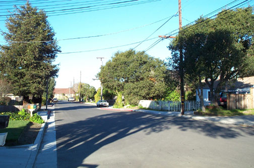
 Location: 7th Avenue, Eaton Street to East Cliff Drive
In April of 1994 the Redevelopment Agency held a community meeting to discuss the proposed road design for 7th Avenue from Eaton Street to the Ocean. Residents agreed that the design presented made sense – sidewalks and bicycle lanes would be added to the existing two travel lanes and street trees would be planted. Specific neighborhood issues identified at this meeting were studied and several options for reducing traffic hazards were presented at the next community meeting held in March of 1995. At this meeting, the suggestion of closing Alpine Street at 7th was determined to be the safest resolution to the traffic conflicts that resulted from the close proximity of this intersection with 7th and East Cliff Drive.
In April of 1996, construction began with storm drains, curbs, gutters, and sidewalks. Retaining walls between the beach and the southern edge of East Cliff Drive helped to accommodate the intersection improvements. After the repaving of the roadway, bicycle lanes were striped and street trees planted. Selected for their ability to survive in the challenging soils and coastal environment were over 70 New Zealand Christmas Trees.
For information on the current road project on 7th Avenue, extending improvements north from Eaton Street to Capitola Road, click here.
Project Completed: July 1996
7th Avenue North of Eaton Street Improvement Project
Location: 7th Avenue from Eaton Street to Capitola Road
At a community meeting held in February of 2001, most residents in attendance supported the concept of having 7th Avenue serve the neighborhood needs first, rather than create a wider street that could be viewed as a thoroughfare. A final plan line proposal was presented to and approved by the Board of Supervisors in June of 2001. Bicyclist and pedestrian safety was enhanced by the construction of bike lanes, sidewalks, bus pullouts, and intersection improvements at Eaton Street, Brommer Street, and Capitola Road. In addition, traffic circulation, visibility, and drainage problems were addressed, and more than 150 street trees were planted.
Completion Date: November 2005
Location: 7th Avenue (Capitola Drive to Soquel Avenue)
Background and History: The Redevelopment Agency and the Department of Public Works developed preliminary plans for the design of roadway and roadside improvements (Plan Line) for 7th Avenue between Capitola Road and Soquel Avenue , primarily in order to improve pedestrian and bicycle access and safety. Plans include maintaining the existing travel lanes, improving the bike lanes, and building new sidewalks, curbs, and gutters where there is none on this stretch of 7th Avenue. In addition, the plans provide some on-street parking and improve sight distance and traffic movements near the intersection of Capitola Road by modifying the striping of the roadway. Other proposed improvements include maintaining the majority of the existing trees, planting street trees where there is adequate room, improving drainage, and constructing separated sidewalks with landscape strips along the Animal Services Authority (formerly SPCA) site’s frontage on Rodriguez Street.
Two community meetings were held on September 7 and November 2, 2006, to consider the proposed improvements. At the first meeting, residents expressed general concerns about speeding traffic and pedestrian and bicycle safety, specifically noting vehicle safety near the intersection of Capitola Road and safety of pedestrians using the cross-walk at the Bostwick intersection. Inadequate lighting was also raised as a concern. Following the first meeting, the plans were revised to address these issues. At the second meeting the proposed revisions were discussed in detail by the residents and staff, and following the community members discussion, the revised plans were accepted by the majority of the residents in attendance. A Plan Line depicting the proposed improvements was prepared based on the results of the last meeting, and the Board of Supervisors approved that Plan Line on January 23, 2007.
The Board of Supervisors awarded the construction contract on September 23, 2008, to Trinchero Construction, Inc., of San Martin, California
Completion Date: The project was completed in April of 2009. Sidewalks, street trees, improved bike lanes and drainage measures have been installed on 7th Avenue from Capitola Road to Soquel Drive. This last and third project on 7th Avenue completes the pedestrian, bicycle and drainage improvements while beautifying the entire length of 7th Avenue from East Cliff Drive to Soquel Avenue with trees.
14th Avenue Improvement Project
Location: 14th Avenue between East Cliff Drive and Merrill Street
14th Avenue (between East Cliff Drive and Merrill Street) is a residential street that had storm drainage, pedestrian safety, and parking issues. "Cut-through" traffic from 17th Avenue and summer beach parking compounded the pedestrian safety and parking problems in this neighborhood. The primary goals of this project were to improve pedestrian safety and organize the parking, while maintaining the neighborhood character and minimizing construction impacts. Following neighborhood meetings, the Agency, in conjunction with Public Works, prepared a plan which was approved by the Board of Supervisors in January, 2006. The improvements included the installation of curb, gutter, and sidewalk on the western side of 14th Avenue, and curb and gutter only on the eastern side. The project also included storm drain improvements and paving.
Completion Date: November 2006.
16th Avenue Improvement Project
Location: 16th Avenue north of Capitola Road
Residents of 16th Avenue had in recent years expressed concern about poor drainage and vehicle safety issues associated with the sharp bend in the road were 16th Avenue turns into Webster Street. On June 7, 2005, a neighborhood meeting was held at the Live Oak Community Center to discuss issues associated with 16th Avenue improvements. Based on input from that meeting, construction documents were prepared, bids were received, and the Board of Supervisors approved construction of the 16th Avenue improvements in May 2006.
The project was carefully designed to maximize protection of existing parking and minimize impacts to the environment and private property. New features include storm drains, driveway conforms, pavement overlay, signage, and striping to delineate parking and the sharp curve at 16th Avenue and Webster Street.
Completion Date: November 2006.
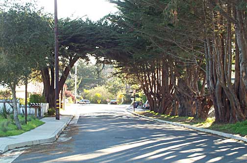
17th Avenue Road Improvement Project
Location: 17th Avenue, from Brommer Street to Capitola Road
 This major north/south arterial in Live Oak provides a route for bicycle traffic, transit and school buses, commercial, residential and through-traffic from surrounding communities. In March of 1989 a route concept and implementation plan for 17th Avenue was presented to the Board. Outlining objectives and improvements from East Cliff Drive to Soquel Avenue, later refined to East Cliff Drive to Capitola Road, it proposed construction in two phases.
Work on the first phase, Brommer Street to Capitola Road, started in the Fall of 1990. It included curb, gutter and sidewalk improvements from Brommer Street to Capitola Road and intersection improvements and signalization modifications at Brommer Street. Storm drainage improvements in the area of 17th Avenue and Kinsley Street helped relieve heavy rainfall problems in the surrounding neighborhoods. Street trees were added as part of the next phase.
Completion Date: February 1991
17th Avenue Road Improvement Project
Location: 17th Avenue, Portola Drive to Brommer Street
 17th Avenue is an increasingly busy street, providing a route for bicycle traffic, transit and school buses, and commercial, residential and through-traffic from the surrounding Live Oak and Santa Cruz communities. It provides access to park sites, the Live Oak fire station, and is used by children traveling to various local schools.
Sidewalks, curbs and gutters were constructed on both sides of the street, with planting strips for street trees. Three travel lanes and a middle two-way turn lane, along with the elimination of all on-street parking helped the flow of traffic. The installation of a rubberized pad surface across the railroad tracks provided a safer crossing area.
Crape Myrtle trees were planted for their small size which works well in tight locations with overhead utility lines. They produce lavender flowers in the summer and are drought tolerant.
Completion Date: Winter 1994
30th Avenue Road Improvement Project
Location: 30th Avenue (Portola Drive to Brommer Street)
Project Manager: James Davies
After a series of community meetings, in 2006 the Santa Cruz Board of Supervisors approved a conceptual plan for improvements to 30th Avenue from Portola Drive to Brommer Street. The completed improvements include two travel lanes and bike lanes on both sides of 30th Avenue between Portola Drive and Brommer Street, continuous sidewalks on the east side of the road, and in-filled sidewalks between Lewis Circle and Portola Drive on the west side of the road. On-street parking was reconfigured to allow maximum parking while accommodating the sidewalk improvements. Storm drainage was also improved as well as the alignment on the intersection of 30th Avenue and Roland Drive. Speed tables replaced the speed bumps in the same locations.
Project Completion Date: Spring 2009
38th Avenue and Garden Street Improvement Project
Location: 38th Avenue and the intersection of Garden Street
Improvements for this project were confined to the western side of 38th Avenue from Brommer to Reposa Streets and the eastern end of Garden Street. Improvements included sidewalk, parking, and new storm drain lines on the west side of 38th Avenue, new curb and storm drain lines along Garden Street, retention of on-street parking, and protection of significant vegetation.
Project Completed: June 2006
Alice Street and Corcoran Avenue Improvement Project
Location: Alice Street from 17th Avenue to Corcoran Avenue and Corcoran Avenue from Portola Avenue to Felt Street
 A community meeting was held in October of 2000 to discuss and solicit residents’ input regarding a plan to improve drainage and potentially other issues. As a result, the plan was expanded to include sidewalks on one side of the street.
 That plan was approved by the Board of Supervisors in December of 2000. It included the construction of sidewalks, curbs and gutters on the north side of Alice Street, curbs and gutters on the south side of Alice Street and drainage improvements for Alice Street. The plan was carefully designed to maximize the protection of existing parking while at the same time maintaining the existing two travel lanes, protecting the existing mature trees and minimizing impacts to personal property. Replacement of the sanitary sewer line and water services was determined to be necessary, and was financed by other funding sources.
Project Completed: December 2002
Location: Brommer Street between 7th Avenue and 17th Avenue
 The Redevelopment Agency and the Department of Public Works held a community meeting in March of 1999 to develop a conceptual plan line to add sidewalks and traffic improvements to Brommer Street from 7th Avenue to 17th Avenue. Based on input received at that meeting the Board of Supervisors approved a conceptual plan line in May of 1999.
The project design was refined over time to ensure that the improvements minimized changes to the character of the area, protected existing parking and trees, and minimized impact to the environment and private property. It provided new sidewalks and bike lanes, a pedestrian crosswalk at El Dorado Avenue, a right-turn lane onto 7th Avenue, storm drainage improvements and landscaping. This project also included replacement of the sanitary sewer lines, financed by the County of Santa Cruz Sanitation District.
Completion Date: April 2003
Brommer II Sidewalk Construction Project
Location: Brommer Street between 17th and Bulb Avenues
Brommer Street is an important east-west street serving the community and neighborhoods. This project covered the installation of curb, gutter and sidewalk on the north side of Brommer only, while allowing room to install sidewalks on the south side in the future. The primary goal was to improve pedestrian access and safety in a manner which minimizes disruption and construction impacts.
Concept plans were prepared and discussed at two community meetings held in November and December of 2002. The route concept, approved by the Board of Supervisors, is to maintain existing traffic and bike lanes, and provide continuous sidewalks for safe pedestrian access along the north side of the street. Construction included 4 foot wide sidewalks on the north side of the street with softer pathway treatment adjacent to the natural area from Rodeo Creek up to Brommer Park at 30th Avenue, bike lanes, storm drainage improvements at Chanticleer Avenue, and retention of on-street parking wherever feasible.
The hillside adjacent to Brommer Street Park was planted with native trees, including California Buckeye, Madrone and Coast Live Oak. Chinese Pistache and Southern Live Oak were planted elsewhere as part of the Agency’s streetscape program.
Completion Date: November 2003
Capitola Avenue Improvement Project
Location: Capitola Avenue between Soquel Drive and the Highway 1 bridge
Capitola Avenue serves primarily a residential neighborhood and is one of the few roads that crosses Highway 1 connecting Soquel to Capitola. Capitola Avenue is also a primary bicycle route form Soquel Drive to Capitola Village and the beaches.
At the community meeting held September 7, 2005, residents were presented with options for improvements to Capitola Avenue from Soquel Drive to the Highway 1 over-crossing. The consensus was to provide a sidewalk for pedestrians on the east side of the street, thereby linking the existing sidewalks, and curb and gutters on the west side of the street. Other improvements included a storm sewer system, new asphalt surfacing, and bicycle lanes on both sides of the street.
Completion Date: December 2006
Capitola Road Improvement Project
Location: Capitola Road between Soquel Avenue and 30th Avenue
 In January of 1999, the Board of Supervisors approved a route concept for Capitola Road. A subsequent community meeting was held in September of 1999 to refine the design plan.
The improvements for this project included: a three lane roadway with two lanes of traffic and a center turn lane, widening to four lanes of traffic at the signalized intersections; improved synchronization of the traffic signals to ease congestion; parking on both sides of the street in areas where significant parking previously existed; completion of the sidewalk system, improving pedestrian access and safety; bike lanes; bus shelters; road repair, paving, striping; street lights; drainage improvements; and significant tree and shrub plantings along the entire project in bulb-out planters along the roadway, and in median islands located in the center of Capitola Road.
Tree removal was minimized by designing the improvements around mature, healthy trees. In addition, over 240 trees were planted as part of the streetscape program. This mix of Hackberry, Hawthorn, Chinese Pistache, Sycamore, Live Oak and Linden trees, assure the existence of an inviting streetscape in the future.
Project Completed: December 2002
Chanticleer Avenue Improvements
Location: Chanticleer Avenue, Soquel Avenue to Harper Street
 A street design plan that included a paved road with two travel lanes, sidewalks, bike lanes, and no on-street parking was developed to enhance the safe and convenient flow of vehicle, pedestrian and bicycle traffic along this important Live Oak collector. Included in the construction plans were new sewer and water lines and storm drain improvements.
At a community meeting held in July of 1989 the conceptual road design was presented to Chanticleer residents and property owners. There was strong support for moving forward with construction of the project as quickly as possible. This extensive project was done in two phases: from Capitola Road to Harper Street, and from Harper Street to Soquel Avenue.
The final touch was a volunteer tree planting day. Property owners could choose from three types of trees: St. Mary’s Magnolia, Southern Live Oak and Chinese flame. The Agency provided the trees and prepared the planting areas. A landscape contractor was provided to help residents with the planting. Even though it rained that day, one resident commented "We had a good time playing in the mud. It’s something my kids will remember."
Completion Date: June 1993
Commercial Way Circulation/Drainage Improvements
Location: Commercial Way, between Highway 1 and Soquel Drive
 The County’s 1994 General Plan identified the area in the vicinity of Commercial Way and Hwy 1 as appropriate for large scale retail development. The Redevelopment Agency, focusing on options to stimulate business development, held a community meeting in March of 1996 to discuss traffic circulation, plans for Commercial way, lower Mission Drive and 17th Avenue, and roadway improvements that could be constructed in conjunction with a proposed retail center.
A second community meeting held in May of 1996, to discuss traffic issues and update residents on changes planned for their neighborhood, lead to further refinements. The final design plan resulted in construction that included:
- a new road, Commercial Crossing, to improve access from Soquel Drive to existing businesses and the new shopping area;
- sidewalks, curbs, gutters and street lighting on Soquel Drive, 17th Avenue, Commercial Crossing, and Commercial Way;
- curbs and gutters on Mission Drive and 17th Avenue;
- drainage facilities on Commercial Way, Mission Drive and 17th Avenue;
- bicycle lanes on Mission Drive, Commercial Way and Commercial Crossing;
- reconfiguration of the freeway ramp at Commercial Way and Hwy 1; and
- new traffic signals on Soquel Drive and the synchronization of existing lights in the area.
Street trees chosen for Commercial Way were the Eastern Redbud, a fast growing, deciduous tree with pink flowers on bare branches in the spring. Commercial Crossing was planted with Tipu trees, which have summer flowers of yellow to apricot color.
Completion Date: November 1996
East Cliff Crib Walls Emergency Repair Work
Location:Pleasure Point Area of East Cliff Drive between Thirty Second Avenue and Thirty Sixth Avenue.
In March of 2004 the County was notified by structural engineers working for the Redevelopment Agency that three existing concrete crib walls had deteriorated to a point where they represented a public safety hazard and collapse could be imminent. The County Board of Supervisors approved a number of actions to protect the public and to ensure that emergency repairs could be undertaken as quickly as possible. The emergency work consisted of drilling soil nails through the existing crib walls and installing a new structure over the face of the existing walls. The walls were finished with sculpted shotcrete, stained to blend in with the surrounding natural terrace deposits. No heavy equipment was allowed on the beach, and no excavation of the beach area below was required.
Completion Date:October 2004
Location: East Cliff Drive, 12th Avenue to 17th Avenue
 East Cliff Drive is a major east-west street in the Live Oak community. Between 12th and 17th Avenues, it bisects a beach community of commercial, residential, and mixed uses. It is an increasingly busy roadway, providing a travel route for local and visitor vehicles, pedestrians, and cyclists accessing nearby commercial and beach resources. It is also an east-west route for traffic from the surrounding Live Oak and Santa Cruz communities. This section of East Cliff Drive provides a commercial "village center" for local residents and visitors with the potential for future development and upgrading opportunities.
In order to incorporate the viewpoints of local residents and businesses, several community meetings were held. Specific issues were identified: safety of pedestrians in an environment with speeding vehicles, unsafe vehicle turning movements, lack of sidewalks and crosswalks, and the fact that widening the road would cause more traffic and wider crossing distances for pedestrians.
The proposed solution included two travel lanes with a middle turn lane, allowing turning movements to occur safely out of the flow of traffic. When turning movements are not necessary, the middle lane becomes a landscaped median enhancing the general roadway and commercial area and visually narrowing the street to help slow traffic. These medians were planted with Strawberry Madrone Trees, an evergreen chosen for their coastal worthiness. Planted behind the sidewalks were Japanese Black Pines, selected for their color, texture and character. Other improvements included adding or relocating crosswalks, highlighting crosswalks for greater visibility, sidewalks and bike lanes on both sides of the street, eliminating back-out and on-street parking and relocation of bus pull-outs from the travel lane.
Additional streetscape amenities, including identification of entryways to the area and the use of special paving materials, were used to identify this section of East Cliff Drive as unique, serving as a village center for the surrounding neighborhoods.
Project Completed: January 1994
Felt Street Road Improvement Project
Location: Felt Street, 17th Avenue to 24th Avenue
The Felt Street Project was designed with the safety of pedestrians and bicyclists in mind, particularly students using this route to the adjacent Del Mar Elementary School.
The section of the project from 17th Avenue to Paget Avenue was constructed with sidewalks and bike lanes on both sides of the street, two striped travel lanes and a striped parking lane on the north side of the street.
From Paget Avenue to 24th Avenue there are two travel lanes, sidewalks on both sides and unstriped parking shoulders on each side of the street which can accommodate informal bike needs.
To complete the road project, the Agency, through a neighborhood volunteer street tree program, provided residents with trees, materials and planting assistance. Property owners selected from Virginia Oak, St. Mary’s Magnolia or Chinese Flame trees and worked in planting teams. At the end of the day, residents expressed genuine satisfaction with the results of tree planting activities, including improved aesthetics, teamwork, and an increased sense of community.
Completion Date: June 1991
Gross Road Improvement Project
Location: Gross Road, Coffee Lane to Capitola City Limit
Gross Road is a residential street that experienced drainage, pedestrian safety, and speeding issues. At a neighborhood meeting in April of 2003, residents generally agreed on wanting street repairs, sidewalks, improved drainage, and reduced speeding on Gross Road, while at the same time maintaining the present character of the neighborhood. A conceptual plan was designed and presented at a second meeting in August that year and adopted by the Board of Supervisors that October. The plan included sidewalk extensions, traffic calming using street bulb outs in conjunction with road bumps, street enhancements, drainage improvements, and retention of on-street parking. The County’s project was coordinated with Capitola’s improvement plans for the intersection of Gross Road and 41st Avenue.
Completion Date: January 2005.
Jose Avenue Sidewalk Infill Project
Location: Jose Avenue, Capitola Road to Rodriguez Street
 Infill projects connect two ends of already existing sidewalks, providing safe places for pedestrians and, usually include upgrading of the drainage system. This infill project consisted of colored concrete curb, gutter and sidewalk improvements on the east side of Jose Avenue. It provided an important link from Capitola Road to Rodriguez Street, a primary route used by children on their way to and from Green Acres School. The addition of curb and gutter on the west side of Jose Avenue was included at the request of the property owners in the neighborhood.
Sidewalks were also constructed between these new improvements and existing sidewalks on the south side of Webster Street. Drainage improvements were also constructed. Reconstruction and re-striping of the Jose Avenue roadbed was funded from the County Road Budget.
Completion Date: September 1998
Kinsley Street Improvement Project
Location: Kinsley Street from 17th Avenue to Lisa Lane and Chanticleer Avenue from Kinsley to Brommer Streets
Kinsley Street serves a primarily residential neighborhood, so on-street parking is heavily used. Problems centered on poor drainage, flooding, speeding, and cut-through traffic, in addition to few pedestrian improvements for residents and school children attending the several schools in the vicinity. At a community meeting held in May 2004, residents favored a sidewalk for pedestrians while retaining adequate on-street parking, resurfacing of the pavement, road bumps, the installation of stop signs at Lisa Lane and Darlene Drive, and the installation of street lights on existing utility poles. The plan line, approved by the Board of Supervisors in September 2004, included curbs and gutters, and some additional sidewalks. The improvements provided parking on both sides with the exception of several areas where there will be no parking in order to allow significant trees and vegetation to remain. Sanitary sewer main replacement occurred prior to this project, while storm drain improvements and partial water main replacement was constructed as part of this project.Completion Date: January 2006.
Lake and Fifth Avenues Improvement Project
 Location: Lake and Fifth Avenues from Eaton Street to East Cliff Drive
Following a year of community discussions regarding the need for improvements in the Twin Lakes Coastal neighborhood, a conceptual design for Lake and Fifth Avenues was prepared and approved by the Board of Supervisors in April of 2002.
At an open house, held in September of 2002, Redevelopment staff presented a refined design concept and project details for review prior to construction which included:

- New wide pedestrian pathway with an informal surface material;
- Retaining walls and safety railings as required;
- Striped and designated bicycle on the harbor side;
- New pavement overlay;
- New parking striping and signage on both sides of roadway;
- Cross-walk striping at key street crossings;
- Upgraded drainage on 5th Avenue;
- New street end islands; and
- Additional landscape, including replacement of trees between East Cliff Drive and the Harbor Master’s Office.
Completion Date: December 2003
Lower 41st Avenue Road Improvement Project
Location: 41st Avenue, East Cliff Drive to Portola Drive
 This project provided pedestrian and bicycle facilities to insure safe access between visitor oriented activities on East Cliff Drive and the commercial area on Portola Drive. It was constructed in conjunction with the Hook Beach Parking Lot Project.
Based on community input and parking surveys, the plan included parking and sidewalk on only one side of the street. Parking was placed on the west side to be most convenient for residents, visitors and businesses. Bulbouts were constructed around three small cypress trees, eliminating several parking places, but allowing the trees to remain. The sidewalk on the west side of the street extends from the existing sidewalks near Portola Drive to the ocean. A short segment of sidewalk was also provided on the east side of 41st to provide a safe pedestrian connection to the Opal Cliff neighborhood. Drainage facilities and a new water main were included in the scope of work.
Completion Date: March 1999
Lower Porter Street Road Bridge Project
Location: Porter Street between Wharf Road and Main Street
This bridge replaced a fifty-year-old triple span bridge. The new arched bridge raised the elevation at the center of the bridge by approximately 2.8 feet to accommodate the passage of storm water and, as a single span structure, prevent the buildup of storm debris around piers. It accommodates two traffic lanes southbound to Capitola Village with a left turn lane onto Main Street. Northbound is a single lane into Soquel Village with one left turn lane onto Soquel Wharf Road. Included were combination bicycle/shoulder lanes and five foot sidewalks and signalization at the intersection of Main and Porter Streets.
Placement of rock slopes and trees planted at selected areas along Soquel Creek provides protection of the creek banks.
This project was done in connection with the Lower Porter Street Road Project, which enhanced and improved this entry street into Soquel Village.
Completion Date: Summer 1994
Lower Porter Street Road Project
Location: Porter Street, Soquel Drive to Soquel-Wharf Road
 One of the major goals for Soquel Village is the enhancement of the shopping district by making it pedestrian friendly. Protecting the small-town, "village" scale while connecting to the higher traffic volumes of the Hwy 1 interchange was accomplished by this project and the Lower Porter Street Bridge Project.
Installation on Porter Street of curbs, gutters, sidewalks, road and drainage improvements, pedestrian scale lighting, bike lanes and a school bus turnout at the elementary school, has improved this street. Connecting the long term parking lot to the central part of the village, a new crosswalk of red brick-like concrete alerts drivers that they are approaching a business district and pedestrian area.
A left turn lane from Walnut to Soquel Drive and conversion to a one-way circulation loop on West Walnut Street and Soquel-Wharf Road created a smoother traffic pattern.
Separated sidewalks on Porter and Walnut Streets were planted with Chinese Pistache, a medium-sized, deciduous tree with orange, red and yellow fall color. The tree is drought tolerant and is a deep rooted, stable tree that will not lift pavement.
Completion Date: October 1994
Main Street/East Walnut Road Project
Location: Main Street, Bridge Street to Sevilla Drive; East Walnut Road
 As part of the Redevelopment Agency’s plan to revitalize the Soquel Village area, this project provided curbs, gutters and sidewalks in addition to repaving Main Street from Bridge Street to Sevilla Drive.
As with most projects, street trees provided the finishing touch. Eastern Redbud trees were planted on Main Street. This is a fast growing deciduous tree with pink flowers that bloom on the bare branches each spring.
The flowering crabapple trees on East Walnut were part of our Volunteer program. The Agency provided the trees, prepared the planting area and assisted the residents in the planting.
Completion Date: October 1994
Location: Park Avenue, Soquel Drive to Cabrillo College Drive
At a community meeting held in the winter of 1994, residents agreed that the major project components - sidewalks, bike lanes, and a middle turn lane – were essential to safety and an improved flow of traffic. The construction timeline developed for this project was very tight in an effort to minimize the length of the construction period and duration of associated disturbance to adjacent properties.
This project provided curbs, gutters, and sidewalks along Park Avenue between Cabrillo College Drive and Soquel Drive. Two travel lanes and striped bicycle lanes were part of the construction, as well as the installation of traffic signals to accommodate the new left turn lane at Park Avenue and Soquel Drive. Due to the narrow width of Park Avenue, the installation of the left turn lane required removal of on-street parking. Since complete elimination of on-street parking would be a major inconvenience to residents and business owners, parking on the west side was temporarily allowed with all on-street parking phased out over time.
With a goal of enhancing the roadways, over 40 trees were planted. Chinese Flame Trees, with brilliant orange to red leaf color in the fall, were chosen for Park Avenue. In the Heritage Grove Area, the dark purple of the Purple Leaf Plums compliment the Coast Redwoods.
Completion Date: September 1995
Pleasure Point Business Area Improvements
Location: Portola Drive, 26th Avenue to 41st Avenue 41st Avenue, Portola Drive to the railroad tracks
 The purpose of the Pleasure Point Improvement Project was to improve pedestrian safety and reinforce the notion of a business area in Pleasure Point that is unique and separate from other surrounding neighborhoods. The construction timing for this complex and extensive project was scheduled in phases to minimize the disruption to local businesses during the critical summer
and holiday seasons.
The purpose of the Pleasure Point Improvement Project was to improve pedestrian safety and reinforce the notion of a business area in Pleasure Point that is unique and separate from other surrounding neighborhoods. The construction timing for this complex and extensive project was scheduled in phases to minimize the disruption to local businesses during the critical summer
and holiday seasons.
Construction began with the undergrounding of overhead utility lines in portions of the area by the utility companies. This was followed by the construction of the sidewalks, curbs and gutters, bus pull-out and shelters, landscaping and roadway improvements by the Agency. Because of the location of existing development and parking, fitting in sidewalks on Portola Drive was challenging in many locations.
The streetscape design was developed with extensive input from area residents and business owners. Through that process it was requested that the area have a "tropical-informal" look. Therefore, the over 80 trees planted on Portola Drive included a mix of Queen Palm, Tipu, Australian Flame, Golden Medallion and Golden Rain trees. The area around the trees includes rocks, grasses and other groundcovers that further the coastal theme. 41st Avenue was planted with another 50 trees, including the Queen Palm and Cassia (Golden Shower) tree, noted for its yellow flower display.
Completion Date: Fall 2000
Porter Street Sidewalk Infill Project
Location: Porter Street, between Soquel Drive and the pathway to the Soquel High School
A minor arterial road with heavy traffic, Porter Street between Soquel Drive and the pathway to the Soquel High School sees a lot of student pedestrians during school times. The primary goal of this project was to improve pedestrian access and safety by completing pedestrian improvements on the east side of this stretch of Porter Street to the high school. Street trees were planted along the west side of the sidewalk to enhance the visual appearance of the streetscape.
Completion Date: Fall 2005
Portola Drive Improvement Project
Location: Portola Drive between 24th Avenue and 26th Avenue
Portola Drive serves as a primary east-west route through Live Oak providing access to beaches, commercial areas, neighborhoods, and schools. Within this highly-traveled corridor, safe pedestrian improvements for residents and school children attending the several schools in the vicinity, and Live Oak Library were lacking.
Improvements included new "natural pave" pedestrian path, landscaping on the north side of the street in keeping with the natural setting of Rodeo Creek and Corcoran Lagoon, storm water drainage improvements, and new street asphalt overlay with new bicycle lane and pedestrian striping.
Completion Date: Spring 2006
Location: Portola Drive, 17th Avenue to Corcoran Street
Working to improve the roadways in Live Oak, the Agency’s goal is to provide for safer, more convenient pedestrian, bicycle, and vehicle travel. A community meeting held in mid-1996 provided an opportunity for area residents to discuss the design and related traffic and parking issues for the project.
The resulting project includes curbs, gutter, sidewalks and bike lanes, repaving of the roadway, on-street parking, crosswalks, bus turn outs and shelters between 17th and 24th Avenues.
This project provided for a new storm drain to Corcoran Lagoon, conveying water that used to flow across Coastview Drive directly to the lagoon. The new drain included a trap to filter urban contaminants from the water prior to its discharge into the lagoon. Also included was the eradication of pampas grass and revegetation of the area with native plants.
Planting strips along the roadside include a mix of Marina Strawberry Madrone, Golden Rain and Japanese Black Pine trees. Chosen for their contrast and texture, they provide changing colors from spring through fall.
Completion Date: Summer 1997
Robertson Street Infill Project
Location: Robertson Street, between Soquel Drive and West Walnut Street<
Linking Capitola with Soquel and serving adjoining residential areas, Robertson Street is heavily traveled by cut-through and local traffic in addition to foot traffic. The primary goal of the project was to improve pedestrian access and safety by completing sidewalk improvements. Steep slopes and large trees presented challenges to the design.
At a community meeting in March of 2004, residents and neighbors were presented with and supported a plan that would improve pedestrian safety with a pathway on the east side of Roberson Street between West Walnut Street and Soquel Drive. The project maintained existing trees and traffic lanes while minimizing the height of retaining walls and impacts to existing buildings.
Completion Date: Summer 2006.
Rodriguez Street Road Improvements
Location: Rodriguez Street, from Capitola Road Extension to Chanticleer Avenue
 An important collector street in Live Oak, Rodriguez Street provides access for children to Green Acres Elementary School. It is also an important link between existing sidewalks and bike lanes on 17th Avenue and Chanticleer Avenue and the bike lanes on 7th Avenue.
Sidewalks, bike lanes, drainage facilities, street lighting, street trees, bus turnouts, relocation of power poles and the installation of street lighting, along with an added crosswalk at 17th and Rodriguez Street comprised this project.
Curbs and sidewalks constructed of colored concrete were used, protecting neighborhood character. Placement of bike lanes behind the trees on the frontage of the former SPCA parcel and the elimination of parking on this section of the block preserved several mature sycamore trees.
Residents participating in the volunteer street tree program were given a choice of Crape Myrtle, Chinese Pistache or Live Oak trees, and provided with professional assistance.
Completion Date: October 1995
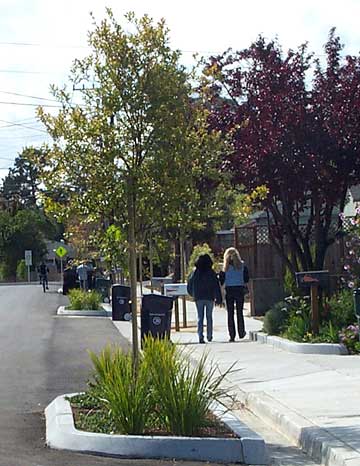
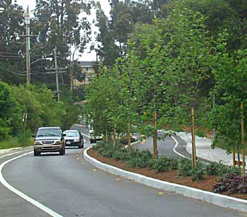
Soquel Avenue Improvement Project
Location: Soquel Avenue (Soquel Drive east to 17th Avenue)
Project Manager: Melissa Allen
Background and History: This segment of Soquel Avenue (from the Highway 1 southbound ramp east to the 17th Ave intersection) is a major east/west arterial roadway which connects Santa Cruz, Live Oak, and Capitola. It also provides one of the primary entrances to Live Oak. Soquel Avenue provides a route for bicycle traffic, transit, commercial, residential and through-traffic from the surrounding communities. It parallels Highway 1 and is located within the designated Highway 1 Scenic Corridor.
Before Construction

A traffic study analyzed the volumes and operations (performance) of existing road segments and intersections and considered various improvement alternatives. Recommendations from the study were incorporated into the project design plans.
This project provided a new pedestrian sidewalk, curb and gutter along the south side of Soquel Avenue to improve public access, safety and drainage. Bicycle lanes were also included on both sides of Soquel Avenue. To improve through traffic flow and intersection movements from Soquel Drive to 17th Avenue, an additional westbound lane was constructed, as well as improvements to the stacking and turn lane length at the Soquel Avenue and 17th Avenue intersection. As this stretch of roadway also represents a “gateway” to Live Oak, an important project goal was to improve the visual appearance along this segment by including street trees and landscaping where possible along the south side of the roadway. These improvements implemented a segment of the Soquel Avenue Plan Line approved in 1991. Project design and construction plans were prepared by Public Works Engineers for the roadside improvements for this segment of Soquel Avenue. Construction was completed in the spring of 2011.
After Construction
Location: The south side of Soquel Drive between 7th Avenue and Highway 1 overpass at Soquel Drive.
Improvements included new concrete driveways and sidewalk along the south side of the street between 7th Avenue and the Highway 1 crossing near the intersection of Soquel Avenue and Soquel Avenue frontage road.
Completion Date: Fall 2005
Soquel Drive Bridge Replacement and Streetscape Project
Location: Bargetto Bridge on Soquel Drive at Soquel Creek
 The conceptual plan line for this portion of Soquel Drive was approved by the Board of Supervisors on May 4, 1993. With receipt of a FEMA grant for replacement of the Bargetto Bridge, a more detailed design process began in 2000. That plan, which was consistent with comments received at several community meetings held on the potential impacts on traffic and local businesses and residents, was approved in October of 2000.
By making the width of the sidewalks six feet on the south side and eight feet on the north side, enough room was made to allow onstreet parking to remain on the south side and provided tree wells for planting on both sides of the street. An interest expressed by the Soquel Village community for a bridge railing which would allow views of the creek and riparian area was accommodated by incorporating an open railing design into the final plans.
The first phase of project construction, started in June, 2001, with construction on the north side of the bridge, the installation of a right-turn lane from westbound Soquel Drive onto Northbound Porter Street, sidewalks on the north side of Soquel Drive from Porter Street to Main Street, and pavement reconstruction of Soquel Drive from Porter Street to Main Street. The second stage began in March, 2002. Utility companies replaced and relocated existing utilities, the Sanitation District installed replacement sewer lines, and the bridge replacement was completed.
Eighteen sycamore trees were planted from Daubenbiss Avenue to Main Street to provide a finished look for this project.
Project Completed: December 2002
Location: Soquel Drive, Walnut Street to Porter Gulch Road
 Community meetings and communications between property owners and the Agency that began in July of 1989 explored a range of options for Soquel Drive. The design phase, completed early in 1991 included the installation of sidewalks on both sides of Soquel Drive from East Walnut Street to Porter Gulch Road and widening of the road.
Construction of additional sidewalk on the north side of Soquel Drive from Hannan Lane to Main street improved pedestrian access to Soquel Village and the elementary school on Main Street, while installation of signal lights at Capitola Avenue provided a fully protected pedestrian crossing.
The completion of catch basins at sag points in the road eliminated an unsightly drainage and erosion problem. Widening of the road to include two traffic lanes in each direction, center medians with turn pockets, and bike lanes afforded safety for the different types of traffic found in this area.
Placement of the medians allows left turns at most major cross points and provides frequent opportunities to make easily negotiated U turns. Modifications suggested by the community improved access to existing businesses and addressed safety issues. The median islands were planted with a mix of Hedge Maple, Eastern Redbud and Sequoias (Coast Redwood) and an undergrowth of shrubs with an irrigation system for proper maintenance.
Completion Date: March 1994
Soquel Drive Sidewalk Infill Project
Location: Soquel, between 41st and Daubenbiss Avenues, and Main and Center Streets
Soquel Drive is a busy arterial road that saw pedestrian safety issues as sections of sidewalk were missing. A Plan Line for improvement to Soquel Drive was approved by the Board of Supervisors in June of 1999. Preliminary plans were prepared with careful consideration of existing vegetation and access to adjacent properties. These plans were shared at a community meeting held in March, 2004 and were generally well received by those in attendance.
This project included sidewalks where they currently did not exist on the north side of Soquel Drive, with street tree planting where there was sufficient room. This project also included minor drainage improvements and maintenance of the existing striping and bike lanes on Soquel Drive.
Completion Date: Fall 2005
Location: Thurber Lane, Soquel Drive to Helen Street
 Thurber Lane, extending for little over a mile north from Soquel Drive is the sole access to Santa Cruz Gardens residential area. With exceptionally good lane width it easily accommodated design plans for the addition of sidewalks and bike lanes.
Construction of this pedestrian safety project began with the installation of storm drains and drainage inlets. Then curbs, gutters, sidewalks and bus stop improvements were added. Striping of travel and bike lanes completed this project.
The forty trees planted in this project area are a mix of Robinson Crabapple, Chinese Pistachio and Coast Live Oak. These trees add a bit of spring and fall color.
Completion Date: Summer 1991
West Walnut Street Sidewalk Construction Project
Location: West Walnut Street
Community meetings were held for this project in October 2004 and January 2005, and those in attendance supported a plan that included a non-separated sidewalk to be constructed on the south side of West Walnut Street in order to improve pedestrian access and safety. The plan minimized the height of retaining walls, the overall width of the street, and impacts to existing trees and vegetation while also maintaining on-street parking and a bike lane. The Board of Supervisors approved the proposed plan line in early 2005. Curb, gutter, and sidewalk construction and street re-paving were completed in summer 2006.
Completion Date: Summer 2006
